
Hong Kong Trail
The Ultimate Guide
The Key Facts
Wall length |44.3km (27.5miles)
Elevation gain |1,684m (5,520ft)
Difficulty |Moderate
Start / End |Victoria Peak / Tai Long Wan Village
Recommended time to hike |October to April
Busyness on trail |Light

Check out my adventure!


The Route
An Overview
The Hong Kong Trail is a great blend of an urban jungle and subtropical wilderness. Winding its way across the length of Hong Kong Island, the trail offers a surprisingly serene multi-day adventure just steps away from one of the world's busiest cities. The 44km route is split into eight sections.
The trail will take you through bamboo forests, alongside dramatic coastal cliffs, and across the undulating ridgelines of the island's central spine. From the panoramic views at Dragon’s Back to the peaceful reservoirs and green forests of the central stages, each segment unveils a new and vibrant side of Hong Kong’s natural beauty.
I completed the Hong Kong Trail in April 2025. It’s a uniquely accessible long-distance hike — where nature meets skyline — and a must for anyone wanting a wild side to their Hong Kong experience.
How difficult is the hike?
he Hong Kong trail is a moderately challenging hike.
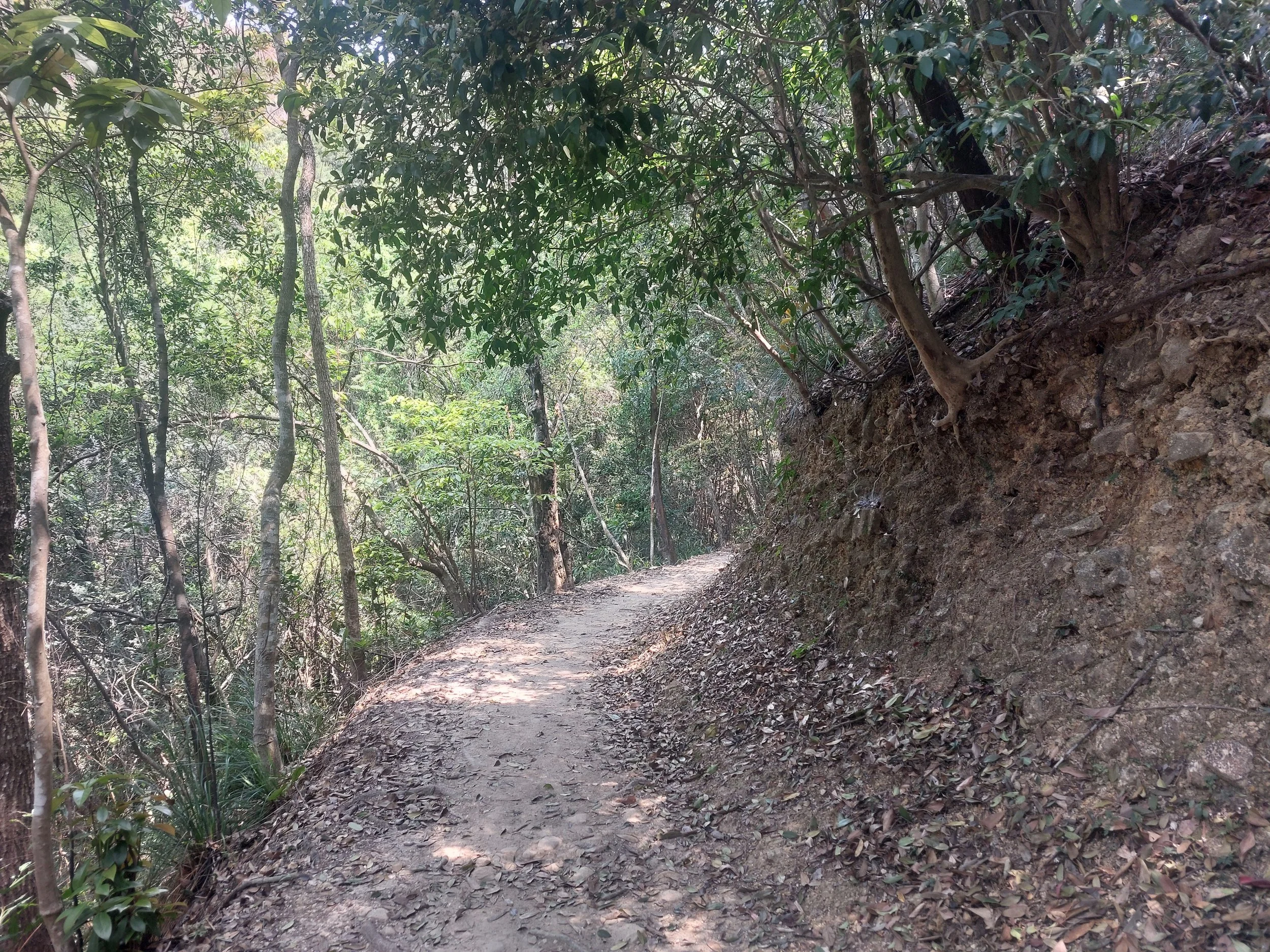
Trail condition - very well maintained and easy to follow. Trail signs are present very often. The path is very well defined, with paved sections and unpaved sections through forested areas.
Steepness - This hike is moderately steep. Hiking over two days for beginers may be challenging. With over 1,600m elevation, the trail will strain your legs, but due to the very good condition of the trail, elevations are made that bit easier.
Trail length - the trail can be done comfortably in two days with a moderate fitness. See my suggested itineraries below for more options of completing the hike.
Weather - see weather section below. Hiking is recommended between October to April to avoid the higher temperatures, increased humidity, and rainfall.
Obstacles and wildlife - Snakes may be present between April and October across the trail in the warmer temperatures of the summer.
The trail is more than easily achievable by self-guiding due to the trail maintanence, quality of direction marking and ease of hike. A perfect hike for all levels.

Highlights of the Walk
These are my top three memories and locations from my journey along the Hong Kong trail:
The view of Kowloon bay from Victoria Peak
The begining of the trail offers unique views of Kowloon bay and Victoria Harbour. Fot the first 3km you will be treated to these sweeping views, where you can admire one of the world’s great cities from above. Whilst Victoria Peak will draw large crowds, once you reach the Lung Fu Shan viewpoint, you will be treated to views of the harbour without crowds, a truly memorable experience!
Aberdeen Country Park
Walk along historic paths surrounded by dense tree cover as you pass steep slopes, streams and cross charming bridges as you take in the sights, smells and sounds of aberdeen country park. I made a detour down to the Aberdeen reservoir and walked along the historic upper Aberdeen main dam. There were few walkers in this area, allowing me to enjoy the area peacefully and at my own pace.
Hiking past Tam Tai Tuk
You will be treated to beautiful scenery whilst passing Tam Tai bay and the Red Hill peninsula. The contrast of this section from the earlier views of Kowloon bay contrast Hong Kong’s diversity as a region. As you continue the hike, you will enter Lan Nai Wan village, where ramshackle village houses remind you of the rustic peace and simplicity of the fishing village in days gone by.

When to go?
There are a couple of things to keep in mind when deciding when to embark on the trail:
-
The best time to hike in Hong Kong is between October and December, although October through April will also provide good conditions for hiking.
During this time, the temperatures will slightly cooler with less humidity and less rain.
Check out the dedicated section on Weather in this guide for more!
-
In a city of 7.5million, the backcountry trails provide a place of solice from the crowded streets. Some important dates to take into account when doing this hike are:
Golden week (labour day) runs from May 1st to May 5th
Ching Ming Festival (Early April)
Lunar new year holidays (end of January to early February)
Easter holidays (Mid to late April)
-
Snakes are particularly present from April to October in Hong Kong due to the warmer temperatures.
Some snakes are venemous like the pit-vipers.
Suggested Itineraries
Below is a list of suggested itineraries from two to three days. You can also find a short description each section of the route, the trail difficulty and notable features. Given the distance, elevation and trail condition, three days is a comfortable duration, although two days is preferred with an intermediate fitness.


The Stages of the Trail
Stage One: Victoria Peak to Pok Fu Lam Reservoir Road
Distance: 7km (4miles)
Elevation gain/loss:
The Hong Kong Trail begins at Lugard Road on Victoria Peak, where you get one of the best views of Victoria Harbour. This peaceful path, built in the early 1900s and named after Governor Sir Frederick Lugard, winds along the hillside with views, old stone benches, and shady trees. In spring and summer, you’ll spot colourful flowers like pink Lance-leaved Sterculia and white Turn-in-the-wind. From there, continue onto Harlech Road and follow the quiet, tree-lined trail toward Pok Fu Lam Reservoir. It’s a nice contrast to the busy city, offering a glimpse of Hong Kong’s more natural side — all just a short walk from the heart of Central. The stage gives the hiker a gentle introduction to the trail with little elevation gain to kickstart the day.

Stage Two: Pok Fu Lam Reservoir Road to Peel Rise
Distance: 4.5km (2.8miles)
Elevation gain/loss:
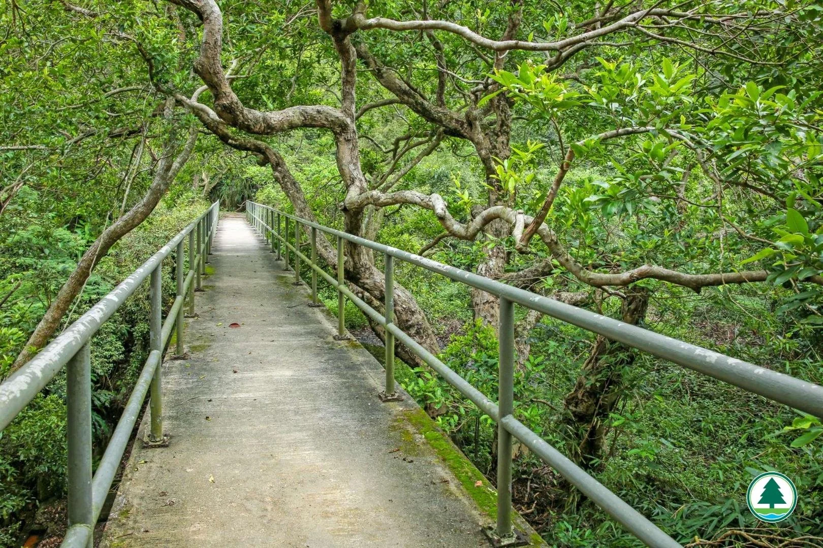
Stage Two of the Hong Kong Trail starts at Pok Fu Lam Reservoir, Hong Kong Island’s oldest, dating back to the 1860s. The trail winds through quiet forests and areas full of birds and insects. Along the way, you'll find benches, pavilions, and a lookout with sweeping views of Aberdeen and Lamma Island. As the trail descends toward Tin Wan, the natural scenery begins to brush up against high-rise buildings; a reminder of how close nature and city life sit in Hong Kong. Near the end, keep an ear out for the sound of streams running through Keung Fa Kan, where the rare short-legged toad has been spotted.
This section is generally easy to moderate, with some gentle ups and downs. Well-paved and accessible, it's suitable for casual hikers, with rest spots and shaded areas throughout.


Stage Three: Peel Rise to Wan Chai Gap
Distance: 6.5km (4.3miles)
Elevation gain/loss:
Stage Three of the Hong Kong Trail begins at Peel Rise, named after a former Governor of Hong Kong. After a short uphill stretch, you may spot a small cascade at Keung Fa Kan, especially during the rainy season. The path soon levels out into a shaded forest trail, lined with ferns and moss. As you continue, views open up over the Aberdeen Upper and Lower Reservoirs, both rich in history. Originally built to tackle water shortages, the granite dam, Renaissance-style valve house, and stone bridge have all become declared monuments and a favourite photo stop for hikers.
The trail here is moderate, with a short climb at the beginning followed by mostly flat dirt paths. It’s a peaceful and steady walk, suitable for most hikers looking for a quiet forest escape with some historical interest along the way.


Stage Four: Wan Chai Gap to Wong Nai Chung Gap
Distance: 7.5km (4.7miles)
Elevation gain/loss:
Stage Four begins at Lady Clementi’s Ride, named after the wife of a former Hong Kong governor. This shaded trail winds past the Aberdeen Reservoirs, offering a quiet escape filled buzzing insect life. As you make your way toward Wan Chai Gap, you’ll cross charming old bridges and pass native trees like Ivy Tree, Reevesia, and the Incense Tree; once so valuable for its fragrant wood that it may have given Hong Kong its name. The trail finishes at Wong Nai Chung Gap, a spot rich with wartime history and remnants from World War II.
This stage is easy to moderate, mostly made up of gentle, well-maintained paths with some small undulations. It’s ideal for a relaxed walk through forested hills, with a mix of nature, history, and heritage all along the way.


Stage Five: Wong Nai Chung Gap to Mount Parker Road
Distance: 4km (2.5miles)
Elevation gain/loss:
Stage Five kicks off at Wong Nai Chung Reservoir, a historic site built in the late 1800s in response to a plague outbreak. Though no longer a key water source, its dam, valve house, and weir are preserved as declared monuments. You’ll climb up to Jardine’s Lookout and Mount Butler, both offering incredible views from Victoria Harbour and Kowloon in the north to Lamma Island and Stanley in the south. It’s a route that shows off Hong Kong from all angles.
This section is fairly demanding, with steep climbs, sharp descents, and a final staircase of 599 steps. It’s best tackled with good fitness and a bit of grit — but the panoramic views make every step worth it.


Stage Six: Mount Parker Road to Tai Tam Road
Distance: 4.5km (2.8miles)
Elevation gain/loss:
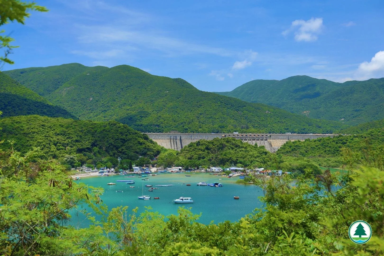
Stage Six begins at Quarry Gap, over 300m above sea level. The trail follows Mount Parker Road, shaded by tall trees that form a leafy tunnel — offering a cool, breezy walk even on warmer days. As you descend toward the Tai Tam Upper Reservoir, you’ll be greeted by calm blue waters and lush green hills. The Victorian-era main dam and stone bridge add a historical touch to the peaceful landscape, making this section both scenic and serene.
This section is easy, mostly downhill and along wide, well-paved paths. It's a gentle and enjoyable walk, perfect for taking your time, snapping photos, and soaking up the quiet charm of the reservoir surroundings.


Stage Seven: Tai Tam Road to To Tei Wan
Distance: 7.5km (4.7miles)
Elevation gain/loss:
Stage Seven begins under a dense trees and gradually opens up to reveal wide views over Tai Tam Bay and Red Hill Peninsula. The path follows the Tai Tam East catchwater, where you can enjoy peaceful coastal scenery, though on weekends, the bay comes bustles with more tourists. Midway through, you’ll pass Lan Nai Wan Village, a quiet reminder of Hong Kong’s fishing village past, with a few weathered houses still standing. The trail gently hugs the hillside, offering lovely views most of the way.
This section is easy to moderate. While most of the route is flat and straightforward, the final stretch includes a short but noticeable descent followed by a steeper climb, just enough to get the heart rate up before finishing.


Stage Eight: To Tei Wan to Tai Long Wan
Distance: 8.5km (5.3miles)
Elevation gain/loss:
The final and longest leg of the Hong Kong Trail begins with a steady climb and rewards you quickly with sweeping coastal views. This section takes you over the famous Dragon’s Back, named for its ridgeline that ripples like a dragon’s spine. From Shek O Peak, you’ll enjoy panoramic views of Shek O, Stanley, and surrounding islands. After that, the trail dips into quiet forest along Wan Cham Shan and Mount Collinson. Eventually, the path leads downhill past Pottinger Gap, finishing in the laid-back surf town of Big Wave Bay.
This section is moderate, with a few uphill climbs at the start and a long descent toward the end. While it's not too difficult, the full length and sun exposure on the ridge can be tiring, so bring water and take your time, the views make every step worthwhile.


Weather
The weather along the Hong Kong Trail is heavily influenced by its subtropical climate. Between June and September, expect hot and humid conditions, with temperatures often ranging from 28–33°C and humidity above 80%. May and June are typically the wettest months, with around 16–18 days of rain each month. The rest of the year tends to be drier, averaging about ten rainy days per month, and the most pleasant hiking conditions are usually found between November and March.
Despite the relatively low elevation, the weather can still shift quickly. One minute you're in dense, shady forest — the next you're on an exposed ridge with the sun beating down or a sudden tropical downpour rolling in. Mist and fog are also common in the higher sections, especially in the mornings.
Top tip: Don’t trust the forecast more than a few days in advance! Weather here can be extremely localised and fast-moving.
Light waterproofs are essential, especially during spring and summer. Sun protection is critical: a cap, high-SPF sun cream and sunglasses will make the exposed stretches more bearable. Always carry at least 2 litres of water; it’s easy to underestimate how much you’ll sweat, and refill points can be infrequent.
Avoid hiking during typhoon season (roughly June to October) unless you’re confident with Hong Kong’s warning system and know when to turn back.
Weather Forecasts
How to do the hike
Being a relatively short long-distance hike, there are several options to completing the hike that you may like to try. The first is going from Victoria Peak (west) to Big Wave Beach (east), or vice versa.
Why hike from West to East (Starting at Victoria Peak)
Gradual progression: Starts high, so the first few sections are mostly downhill or undulating, easier on fresh legs.
Build-up effect: Scenery and wildness gradually increase throughout the hike.
Easier logistics in the beginning: Victoria Peak is easy to reach via public transport, especially from Central.
Symbolic start: Victoria Peak is iconic, you start with beautiful views over Hong Kong’s skyline and harbour.
Finishing at the beach: Ending at Big Wave Bay is a great place to relax and enjoy the sea with a cold drink in hand!
Why hike from East to West (Starting at Big Wave Beach)
Start wild and scenic: Eastern sections (like Dragon’s Back in Section 8) are more rugged, dramatic, and natural — energising way to start.
Cooler in the morning: East-facing cliffs and coast catch the morning sun, good light and cooler air for early start.
Satisfying climax at The Peak: Finishing at Victoria Peak feels like reaching a "summit" and offers a final reward of urban views.
Sections get easier over time: You tackle the most strenuous bits early, when you're fresh.
Splitting the hike from Aberdeen
Want to finish both days of the hike in stunning locations, why not start both days from Aberdeen!
Day One: Aberdeen to Victoria Peak (21km distance)
Day Two: Aberdeen to Big Wave Beach (23km distance)
Getting to the Hong Kong
Check out the latest visa requirements for Hong Kong here

Find your perfect flight!
Getting to Victoria Peak
The start of the trail!
Via funicular (The Peak Tram)
The peak tram is open between 7:30am to 11pm every day
The tram takes 10mins to reach the peak!
The tram is located at The Peak Tram Central Terminus, 33 Garden Road, Central, Hong Kong
The closest metro stations are Admiralty or Central
Ticket prices:
Single: Adult (76HKD); Child / Senior (38HKD)
Return: Adult (108HKD); Child / Senior (54HKD)
Via bus
Bus 15 from Admiralty / Exchange Square to The Peak takes approximately 30mins
Ticket prices are 10-15HKD.
Buses every 5-8 minutes.
Getting to Aberdeen
Aberdeen is known as the halfway point of the trail. Whether you plan to do only one day of hiking, or are taking Aberdeen as a break point, it can be a useful place to enter the trail.
From Kowloon
Bus 170 runs directly from Kowloon to Aberdeen and takes 45mins
A useful stop to get off at is Aberdeen Tunnel Toll Plaza
From Central
Take the South Island Line from Admiratly to Ocean Park (15mins only!)
If travelling from Star Ferry Pier, take the Tsuen Wan Line from Tsim Sha Tsui before changing over at Admirarlty onto the South Island Line.
Getting back from Big Wave Bay (the end!)
From Big Wave Bay, walk 15mins along Big Wave Road to Shek O Road
From there, take the Citybus 9 or X9 back to urban areas including Shau Kei Wan
From Shau Kei Wan, hop on the Island Line Metro to take you into Hong Kong Island!
Accomodation
You will find a variety of accomodation for the Hong Kong Trail, and what you choose will depend on your specific needs and requirements. Below you will find a guide to camping, refuges and hotels / bed and breakfasts.
-
Campsites
Official campsites aren’t present on the trail, but wildcamping is a great way to spend the night on trail.
-
Check out my map above in this guide for a comprehensive guide to ALL of the permitted areas (known as Barbecue sites) for wildcamping.
Aberdeen Country and Tai Tam Country Parks offer plentiful locations to set up your tent. The sites are typically basic with little supplies so do make sure to bring all the necessary food, water etc.
In addition, toilets are often also not present in the barbecue sites.
-
The town of Aberdeen offers several hotels for an easy one-night stay before completing the next stages of your hike.
Another alternative is to take the bus / metro back to Central / Kowloon due to the ease that public transport connects you to the city centre.

Barbecue site - Aberdeen Country Park

Barbecue site - Aberdeen Country Park

Barbecue site - Tai Tam Country Park
Packing Advice
Deciding what to pack will vary on the days spent on the hike as well as your fitness ability and other factors such as weather. Below is advice on what to pack for the hike.
Essentials
Footwear - the most important item you should invest in. Bring a good, quality worn in pair of hiking boots / trail runners. This will prevent blisters, general pain in your legs and will keep your feet warmer and dryer.
Waterproofs - do not expect Mediterranean weather in the Picos de Europa. Rain and snow are especially common between June and Septmebt with showers to be expected year round.
Water - availability along the trail is limited, so you should plan accordingly. See my section below on water!
Suncream - Hong Kong is known for its hot climate. Especially as you reach the end of the trail, there sections without cover for several kilometres.
Powerbank - see my section below on Phone and Internet.
Optional
Trekking poles - the elevations don’t require trekking poles, but nevertheless they will of course help especially if you want to minimise pressure on your knees.
Camping gear - depending on how you are sleeping along the trail, an appropriate tent, sleeping bag, sleeping mat will be required. See my gear of 2025 for inspiration as well as my top 10 packing tips!
Food and Water
Typical foods
Hong Kong has a vibrant culinary scene blending Cantonese roots with international flair. Some of the highlights include:
Dim sum – bite-sized portions of dumplings, buns, and rolls served in bamboo steamers, often eaten with tea.
Char siu – Cantonese-style barbecued pork, glazed with honey.
Wonton noodles – thin egg noodles in a clear broth, topped with shrimp or pork wontons.
Egg tarts – flaky pastry shells filled with smooth, sweet egg custard.
Snake soup – a delicacy made with snake meat, mushrooms, and herbs.
Clay pot rice – rice cooked in a clay pot with toppings like Chinese sausage, chicken, or mushrooms, served with soy sauce.

Dim Sum

Char siu

Wonton noodles

Egg tarts

Pineapple bun

Snake soup

Clay pot rice
Supermarkets
Supermarkets are available in Hong Kong Island (Central), Aberdeen and Big Wave Beach. However, do not expect the same availability of produce as supermarkets in Europe. I had to visit three supermakets in Kowloon before I found the ingredients for a sandwich. It’s much more typical to east hot food in Hong Kong.
Restaurants
Check out my map for a list of restaurants along the trail!
Gas Canisters
You can buy gas canisters at the following locations:
RC Outfitters (several locations)
Water
Water availability along the Hong Kong Trail is limited, so hikers should plan accordingly. While some stages pass near urban areas or parks where public toilets with water taps are available (such as at Peel Rise, Parkview, or near Big Wave Bay), these sources are not always reliable or intended for drinking.
There are no dedicated refill stations along most of the trail, and natural water sources are either scarce or unsafe to drink without treatment. It is strongly recommended to carry enough water for each stage, especially in hot and humid conditions and to check ahead for any accessible refill points if splitting the hike into sections.


Maps and Waymarking
Maps come in two forms: digital or printed. Personally, I like the feel of a printed map as well as knowing its battery won’t die on you. Digital maps have advantages including often a GPS tracker, live weather forecasts and general ease of use and small size compared to a map. However, phones are dependent on battery life, sometimes internet signal and the performance of your phone can vary on a cold night or with heavy rain it may be difficult to use the touchscreen.
Maps require more planning. I like to draw the route out with a sharpie. Maps are often bulkier and the often cost between £10 - £20 each. However, self-navigating can be a rewarding and fun process on the trail. Don’t forget a compass too whe using a printed map.
Given the nature of this trail, being very well marked and easy to follow, I used the app AllTrails to navigate with very little issues.
Online Maps:
For trails where navigation does not require much thought, AllTrails is a great tool that you can use to get a bearing of distance and elevation.
The free version allows you to use maps offline provided you have loaded everything prior to setting off with internet.
The paid version gives you more perks including offline maps.
Download your own GPX files
Printed Maps:
Countryside Series Maps (Survey and Mapping Office, Hong Kong)
Maps can be bought at the Map Publication Centres in Kowlon or Hong Kong Island
Map: Hong Kong Island (1:25,000)
The Serious Hiker’s Guide to Hong Kong
Buy on Amazon here
Guidebook including maps for the Hong Kong Trail (and the other major trails of Hong Kong)
Waymarking
The route is very clearly marked along its entirety. I found waymarking very easy along the entire trail.
The trail is extremely well maintained, nothing more to say!
Waymarking post
Very well maintained trails

Waymarking post
Cash or Card
Answer: Cash for the countryside; Card for the city
Currency: Hong Kong Dollar
Card-friendly areas:
MTR (Mass Transit Railway): Use your Octopus card (HK’s transport smart card) or Visa/Mastercard with contactless.
Shops & Cafés: Card payments (Visa/Mastercard/Apple Pay) are widely accepted in areas like The Peak or Shek O.
Octopus Card: Super useful payment method (Apple only) works on buses, ferries, vending machines, 7-Elevens, and some small cafés.
Cash is required at the following:
Once you're mid-trail, things get a bit more rustic.
Kiosks or small stores along the trail (like at Tai Tam Reservoir, near Parkview, or at the end in Shek O) might only take cash or Octopus.
Public toilets and water fountains are free, but some vending machines only take Octopus or small coins.
Useful tips:
Carry around HK$100–200 in small bills and coins for:
Snacks or drinks from old-school shops or mobile vendors
Public minibus fares (some don’t take cards)
Keep your Octopus card topped up, it’s really useful for getting around or grabbing a cold drink at a vending machine.
If you're relying on mobile payments (Alipay/WeChat Pay), they’re accepted in some places but not universal on trail-side shops.
What is Octopus payment?
Octopus is Hong Kong’s iconic contactless smart card used for everyday transactions. Think of it like a prepaid debit card with tap-to-pay convenience.
How it works?
Tap to pay on card readers, no PIN or signature needed.
Works offline, which is perfect for hiking areas where there's no signal.
Can be used on public transport, in convenience stores, vending machines, some eateries, and even public swimming pools.
What types of payment card exist?
Physical Card – Basic version, easiest to get
Octopus Mobile – Works with some Android phones but mostly Apple
Smart Octopus in Samsung Pay / Apple Wallet – Digital versions
Tourist Octopus (Sold Tourist Octopus) – Preloaded, non-refundable version tailored to visitors
Phone and Internet
Wifi
Public Wi-Fi is not available along most of the Hong Kong Trail, as it traverses remote, forested areas and country parks where connectivity infrastructure is limited. However, at the start and end points such as Victoria Peak (Stage 1) or Big Wave Bay (Stage 8), you might find free Wi-Fi in nearby cafes, visitor centres, or public facilities. Don’t rely on Wi-Fi for navigation or communication during the hike; instead, download offline maps beforehand.
Mobile data
Mobile data coverage is generally good along the Hong Kong Trail. Most sections of the trail, even those winding through hills and forests, still receive 4G or even 5G signal. That said, brief signal drops may occur. Using GPS apps or map tools in offline mode is recommended.
Mobile providers of Hong Kong include: CSL Mobile, SmarTone or Three Kong Kong. These provide tourist sim deals for your visit. Many hostels also offer the option to rent a sim for the duration of your stay and will insert the sim and sort everything out for you at a very reasonable price.
Charging
There are no charging stations along the Hong Kong Trail itself, so it’s important to start your hike with a fully charged phone and carry a powerbank, especially if you’re hiking multiple stages or relying on your phone for navigation. If you plan to charge devices before or after your hike—such as in a café, public facility, or hotel near trailheads, Hong Kong uses the British-style Type G plug (three rectangular prongs) If you're visiting from abroad, bring a suitable adapter to ensure you can charge your devices without issue.
Languages
English and Cantonese are both widely used along the Hong Kong Trail. Trail signs, maps, and public transport information are typically bilingual, making navigation easy for international hikers.
Hello - nay ho | 你好
Goodbye - joy geen | 再見
What’s your name? - nay gyu meh meng? | 你叫咩名?
North East South West - buck, dung, naam, sigh | 北, 東, 南, 西
Mountain - saan | 山
City - sing see | 城市
Footpath - siu ging / haang saan ging | 小徑 / 行山徑
Hotel - jow deem | 酒店
Restaurant - chan teng | 餐廳
Do you speak English? - nay sick mm sick gong ying man? | 你識唔識講英文?
Food - sick mut / yeh sick | 食物 / 嘢食
Toilet - chee saw | 廁所
Water - sui | 水
Beer - bear jow | 啤酒
Noodles - meen | 麵
Can I pay please? - ngaw haw yee bay cheen ma? | 我可以畀錢嗎?
Thank you - dor jeh (gift/favor) / mm goy (service) | 多謝 / 唔該
Key Contacts and Emergencies
Dial 999 for ALL general emergencies (including mountain search).
Make sure you have adequate insurance cover. It is advisable to leave a copy of your insurance with a member of family or friend, and take the original with you.
Further References
There are some great ways to get further information regarding the hike! These three resources are where I find out most about any hike, not just the Hong Kong Trail.

-
The Hong Kong hiking website provides a detailed breakdown of the Hong Kong trail.
Split into each stage, the website provides the following:
Trail summary with difficulty ratings
Short descriptions of each stage
Downloadable .gpx files for your navigation
Transportation information
Gallery
-
AllTrails is a great place to hear feedback from other fellow hikers and get a feel of the trail conditions through dated photographs.
The maps are easy to follow, a great app to use.
-
My go to guides are always Cicerone.
The ‘Hiking in Hong Kong’ guidebook gives you detailed descriptions on the Hong Kong Trail, Machelose Trail, Lantau and Wilson trails, as well as 21 day hikes. I would thoroughly recommend this book if you are planning staying in Hong Kong for an extended period of time.
You will be able to learn abut the local area’s deep history as well as the geology of the area through this guide.

